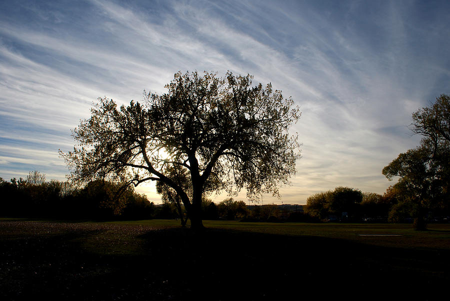
Standing Alone Against the Evening Sky

by Greni Graph
Title
Standing Alone Against the Evening Sky
Artist
Greni Graph
Medium
Photograph - Photography
Description
Streams of clouds against the blue sky accent this sturdy tree along Rapid Creek. Rapid Creek is a tributary of the Cheyenne River, approximately 86 mi (138 km) long, in South Dakota. It rises in southwestern South Dakota, in the Black Hills National Forest in the Black Hills in Pennington County. It flows east, is joined by Castle Creek, past Silver City and through the Pactola Reservoir. Emerging from the Black Hills, it flows through Rapid City, past Farmingdale, and joins the Cheyenne approximately 13 mi (21 km) southwest of Wasta. Rapid Creek is most noted for the Black Hills flood of 1972. Pactola Lake is the largest reservoir in the Black Hills of South Dakota and is created by the Pactola Dam. At the bottom of Pactola Lake is the submerged town of Pactola, an old mining camp and site of several military bivouacs during the original settlement of the Black Hills in the mid-1870s. The lake is located on Rapid Creek in Pennington County, South Dakota. The lake provides the water supply for the Rapid City Metro Area. It is owned and operated by the U S Bureau of Reclamation, with the various recreational facilities operated by the US Forest Service, and is one of the recreational areas of Black Hills National Forest. Boating and fishing are very popular, with a walk-in fly-fishing area located on Rapid Creek below the dam. Facilities include a marina, improved swimming beach, campgrounds and group campground on the South Shore, campgrounds and a handicapped fishing path on the North Shore, and various picnic and overlook areas. In the summer, the USFS operates a visitor center on the dam, immediately off US Highway 385. The dam across Rapid Creek is very large, and was enlarged following the Black Hills Flood of 1972; lake water levels vary enormously, as the lake is used for flood control, domestic water, streamflow maintenance, and irrigation. Pactola Lake is accessible via US Highway 385 north from Hill City, South Dakota and Sheridan Lake Forks or south from Lead and Deadwood, or via the Rimrock Highway, SD Highway 44 from Rapid City, South Dakota. Fees are charged in summertime for all facilities. Boating (both power and sail), fishing, swimming, and other outdoor activities are popular in the summer; in wintertime, ice-fishing, ice-skating, and some cross-country skiing is popular. The small town of Silver City is located at the upstream end of the lake; downstream on Rimrock Highway and Rapid Creek are the communities of Johnson Siding, Hisega, Upper Hisega, Placerville, and Big Bend. #201010190181
Uploaded
September 16th, 2011
Statistics
Viewed 863 Times - Last Visitor from Norwalk, CT on 04/25/2024 at 10:31 PM
Embed
Share
Sales Sheet
Comments (3)

Dakota Light Photography by Nadene
Thanks very much, Nadine and Bob, for featuring Standing Alone Against the Evening Sky in ARTISTS NEWS!

Nadine and Bob Johnston
.... Like the subject, technique, composition, and color... Today it was Published in the Internet publication ARTISTS NEWS.... Anyone can Just Highlight this link ---- http://bit.ly/RVPlpf - Use Ctl-C to copy and Ctl-V ---- to put it into the Browser Address, to view the publication. You can then, Tweet, FB, and email, etc a copy of the publication, to just anyone you feel would be interested. Happy Promoting! :-)


